Maybrook Trailway (Putnam Trailway - CT Border)
Rail-trail in Connecticut and New York · OpenStreetMap relation

About this trail
This roughly 4.4-mile paved segment is the southern, older portion of the Maybrook Trailway, running east from the village of Brewster in the Town of Southeast, Putnam County, New York, to the Connecticut state line at Danbury. News coverage of the 2021 trailway opening describes it as an existing 5.5-mile scenic route along the East Branch Reservoir in Southeast. The corridor is the Beacon Line, the former Maybrook Line of the New York, New Haven and Hartford Railroad, which opened in 1892 as the first all-rail freight link across the Hudson River north of New York City, running from Derby, Connecticut, to Maybrook, New York, over the Poughkeepsie railroad bridge. Passenger service ended in 1927; a May 1974 fire on the Poughkeepsie bridge cut the route west of Hopewell Junction, Conrail rerouted New England freight through Springfield in 1992, and Metro-North bought the line in 1995 for $4.2 million. The Connecticut portion from the state line to Danbury is owned by the Housatonic Railroad.
At Brewster the trail meets the Putnam Trailway, a 12-mile paved path on the former Putnam Division of the New York Central Railroad (the "Old Put," 1881–1958) that runs south to Baldwin Place and connects there to Westchester County's North County Trailway toward New York City; Metro-North's Brewster station on the Harlem Line also provides access. Northwest from Brewster, the 23-mile Maybrook Trailway segment completed by Metro-North in January 2021 with $42 million in state funds continues to Hopewell Junction and the Dutchess Rail Trail, closing the final gap in the 750-mile Empire State Trail. TrailLink lists the southern endpoint as 123 Mill Plain Road, Danbury, with parking at Southeast Town Park on Pumphouse Road near Lake Tonetta.
The surface is asphalt and the grade is nearly flat. Reviewers note a river bridge in Brewster that reopened after a period of closure. In February 2024 the Surface Transportation Board approved Metro-North's abandonment of 41 miles of the Beacon Line between Beacon and the Connecticut border for interim trail use.
Sources checked Oct 12, 2026 · CC BY 4.0
Photos
-
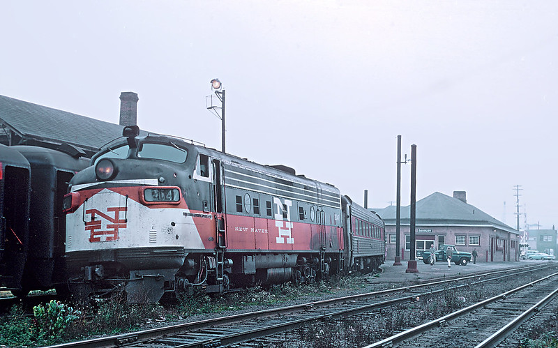 Danbury, along the trail
Photo: railfan 44 · Public Domain Mark · Flickr -
 Danbury, along the trail
Photo: railfan 44 · Public Domain Mark · Flickr -
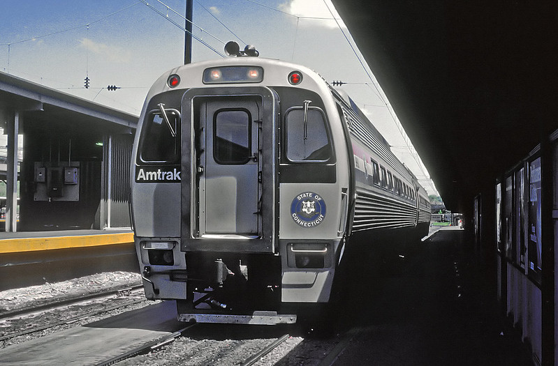 Danbury, along the trail
Photo: railfan 44 · Public Domain Mark · Flickr -
 Danbury, along the trail
Photo: aldenjewell · CC BY · Flickr -
 Danbury, along the trail
Photo: MikeKalasnik · CC BY-SA · Flickr
Photos and rider notes
Trailheads
- 1 Parking directions
- 2 Parking directions
- 3 Parking directions
- 4 Parking directions
- 5 Parking directions
- 6 Parking directions
- 7 Parking directions
- 8 Parking directions
- 9 Parking directions
- 10 Parking directions
- 11 Parking directions
- 12 Parking directions
- 13 Parking directions
- 14 Parking directions
Take it with you
Open data, ODbL. Attribute BikeTheRail and OpenStreetMap contributors.
Something wrong?
Closed section, wrong surface, missing piece? Tell us and a person will check it. Report a problem.
Sources
- OpenStreetMap relation 11370193, OpenStreetMap contributors · Map data · ODbL · checked Oct 12, 2026
- Official trail website · Official site · checked Oct 12, 2026
- Putnam Trailway Brochure — Putnam County, NY · government source · checked Oct 12, 2026 Supports: Putnam Trailway 12.0 mi Baldwin Place–Brewster, paved, former New York Central Putnam Division, service 1881–1958, 'Old Put', connection to North County Trailway
- Beacon Line — Wikipedia · organization · checked Oct 12, 2026 Supports: Maybrook Line of the New Haven Railroad, Maybrook–Poughkeepsie Bridge–Derby route, passenger service ended 1927, May 8 1974 bridge fire, Conrail 1992 rerouting, Metro-North purchase 1995 for $4.2M, Housatonic Railroad owns Connecticut portion to Danbury, STB abandonment approved February 2024
- Maybrook Trailway Opens, Completing 750-Mile Empire State Trail — Patch (Southeast, NY) · press · checked Oct 12, 2026 Supports: existing 5.5-mile segment along East Branch Reservoir in Southeast, Putnam Trailway and North County Trailway connection, 750-mile Empire State Trail
- MTA Metro-North Railroad Announces Opening of Major Segment of Empire State Trail — MTA · web · checked Oct 12, 2026 Supports: January 2021 completion of 23-mile segment, $42M state funds, Brewster to Hopewell Junction, Beacon Line history 1892, passenger service ended 1930s, 1974 bridge fire, connection to existing 5.5-mile Maybrook Trailway and Putnam Trailway in Brewster, asphalt 8–10 ft wide, Brewster station access
- Maybrook Trailway — TrailLink · web · checked Oct 12, 2026 Supports: asphalt surface, southern endpoint 123 Mill Plain Rd Danbury CT, Southeast Town Park parking on Pumphouse Rd near Lake Tonetta, Brewster river bridge reopened after staircase bypass
Every fact above cites a numbered source and the date it was last checked; the list is rebuilt nightly. Know a better source? Add a reference.